Wendy Fjellstad
Forsker
(+47) 974 81 279
wendy.fjellstad@nibio.no
Sted
Ås - Bygg O43
Besøksadresse
Oluf Thesens vei 43, 1433 Ås (Varelevering: Elizabeth Stephansens vei 21)
Biografi
Sammendrag
Det er ikke registrert sammendrag
Forfattere
Philippe Jeanneret Gisela Lüscher Manuel K. Schneider Philippe Pointereau Michaela Arndorfer Debra Bailey Katalin Balázs András Báldi Jean-Philippe Choisis Peter Dennis Mario Díaz Sebastian Eiter Zoltán Elek Wendy Fjellstad Thomas Frank Jürgen Kurt Friedel Ilse R. Geijzendorffer Pippa Gillingham Tiziano Gomiero Gergely Jerkovich Rob H. G. Jongman Max Kainz Anikó Kovács-Hostyánszki Gerardo Moreno Juri Nascimbene Marie-Louise Oschatz Maurizio Guido Paoletti Jean-Pierre Sarthou Norman Siebrecht Daniele Sommaggio Sebastian Wolfrum Felix HerzogSammendrag
Det er ikke registrert sammendrag
Sammendrag
Det er ikke registrert sammendrag
Forfattere
Wenche Dramstad Wendy Fjellstad Geir-Harald Strand Henrik Forsberg Mathiesen Gunnar Engan Jogeir N. StoklandSammendrag
Det er ikke registrert sammendrag
Sammendrag
Det er ikke registrert sammendrag
Sammendrag
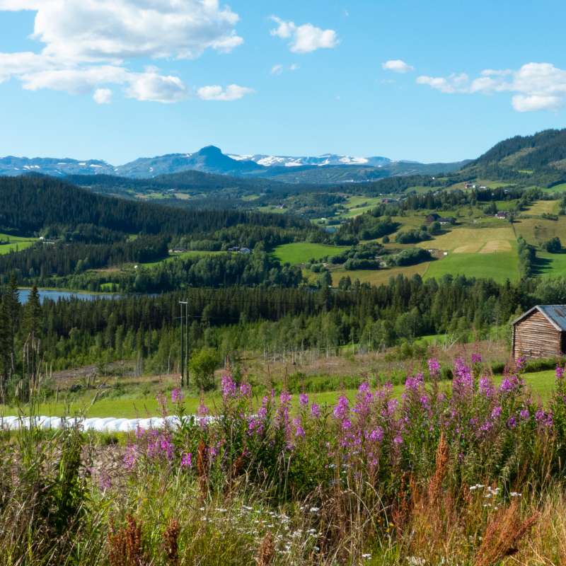
In modern agricultural landscapes, «the green in between» plays a crucial role in supporting the survival of many plant and animal species. These areas include field margins, grassy banks between fields, mid-field islands of uncultivated vegetation, rocky outcrops, fallow land, and other patches of unused ground. We surveyed vascular plant species in these green spaces and compared the results with a similar survey conducted 18 years earlier. Our findings reveal a general decline in species richness, including many plants important for pollinators. Nevertheless, numerous green patches remain species-rich and continue to provide valuable resources for pollinators. Among these, road verges stood out as the most diverse. This suggests that active management of the green in between—such as removing invasive species and implementing regular mowing to maintain flower-rich patches—could significantly enhance its value for wildlife and biodiversity conservation.
Forfattere
Christian Levers Marcel Schwieder Petra Dieker Stefan Erasmi Roberto Azofeifa Rodríguez Ulrike Bayr Ana Julieta Calvo Obando Wendy Fjellstad Satsuki Furubayashi Janne Heliölä Felix Herzog Terho Hyvönen Linda Ieviņa Pēteris Lakovskis Eliane Meier Hannu Ojanen Timo Pitkänen Walfrido Moraes TomasSammendrag
This paper outlines the rationale for, and the current state of, mapping habitat diversity. It provides an overview of progress in assessing and monitoring farmland habitat biodiversity at the national level, in line with the proposed OECD Farmland Habitat Biodiversity Indicator (FHBI). The paper describes pilot studies by eight countries, summarising the approaches to mapping habitats, assessing habitat quality, and implementing the FHBI at the national level. Drawing from the experience of the FHBI pilot countries, this paper offers general guidelines for defining habitats and assigning biodiversity values of habitats for calculation of the FHBI. It provides guidance on selecting the appropriate tier level for data acquisition, processing, and reporting, and summarises strengths, weaknesses and opportunities of the current FHBI structure used in the pilot studies.
Sammendrag
Det er ikke registrert sammendrag
Divisjon for kart og statistikk
Integrering av klima, miljø og folkehelse i det norske matsystemet for å vurdere effektive, trygge og akseptable politiske alternativer
Norges matsystem utfordres ikke bare av interne målkonflikter, men også av økende ambisjoner knyttet til landbruk og mat fra andre politikkområder. Utslipp av klimagasser fra landbruket må reduseres, tap av natur og biologisk mangfold må stanses, og nye kostholdsanbefalinger forventes å flytte kostholdet mot mindre kjøttforbruk og -produksjon.

Divisjon for kart og statistikk
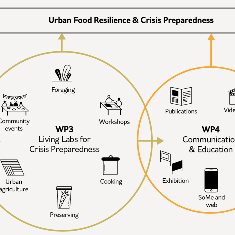
Styrket individuell, kollektiv og offentlig beredskap gjennom urbant landbruk og sanking (BestPrepared)
Hvordan kan vi styrke samfunnsberedskapen gjennom urbant landbruk og sanking?
Divisjon for kart og statistikk
Building resilience through urban agriculture and foraging: individual, collective and public preparedness (BestPrepared)
How can we strengthen societal preparedness through urban agriculture and foraging?