Sebastian Eiter
Seniorforsker
(+47) 974 81 109
sebastian.eiter@nibio.no
Sted
Ås - Bygg O43
Besøksadresse
Oluf Thesens vei 43, 1433 Ås (Varelevering: Elizabeth Stephansens vei 21)
Biografi
Sebastian Eiter er geograf (dr.polit.) og landskapsøkolog. Hans fagområder er drivkrefter og konsekvenser av endringer i jordbrukets kulturlandskap, kulturminner og -miljøer, biologisk mangfold, medvirkning og urbant landbruk.
Sammendrag
NORSØK og NIBIO har gjennom flere år brukt det globale verktøyet SMART Farm til å analysere bærekraft på en rekke norske gårder i ulike forskningsprosjekt. En grundig sammenligning mellom SMART Farm og KSL viste stor grad av overlapp (Eiter m.fl. 2025) på mange områder innen blant annet dyrevelferd, helse, miljø og sikkerhet, produktkvalitet, bruk og håndtering av gjødsel og plantevernmidler, kildesortering og håndtering av avfall. Bøndene som driver i henhold til KSL oppnår derfor gode resultater innen disse områdene. Samsvaret mellom de to systemene bekrefter den høye graden av tillit som norsk matproduksjon har blant forbrukere. SMART Farm inneholder en del viktige indikatorer for bærekraft som ikke fanges opp av KSL. Dette handler i stor grad om sosial og økonomisk bærekraft, som blant annet lønnsomhet, arbeidsmengde, ferie og fritid, rekruttering, økonomisk sikkerhet ved sykdom, bondens dugnadsinnsats i lokalsamfunnet og bondens bidrag til å skape arbeidsplasser.
Forfattere
Sebastian EiterSammendrag
Det er ikke registrert sammendrag
Sammendrag
Det er ikke registrert sammendrag
Divisjon for kart og statistikk
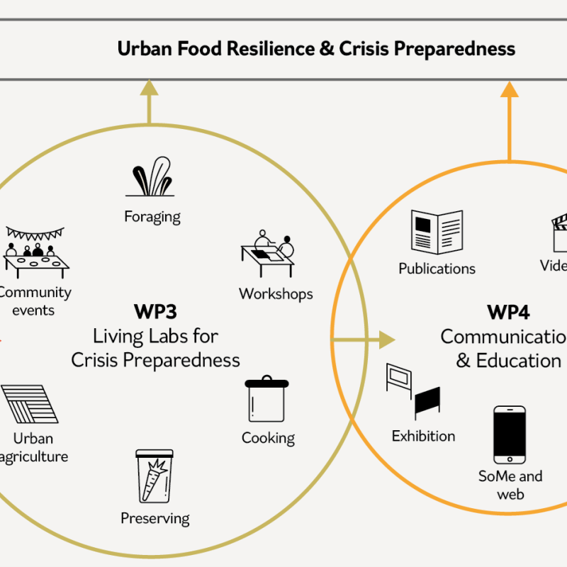
Styrket individuell, kollektiv og offentlig beredskap gjennom urbant landbruk og sanking (BestPrepared)
Hvordan kan vi styrke samfunnsberedskapen gjennom urbant landbruk og sanking?

Divisjon for kart og statistikk
Building resilience through urban agriculture and foraging: individual, collective and public preparedness (BestPrepared)
How can we strengthen societal preparedness through urban agriculture and foraging?
Divisjon for kart og statistikk
Mitigation and Adaptation in Cultural Heritage Landscapes: Lessons from Transhumant Pastoral Systems for Managing Novel Climate Risks (PastAdapt)
Cultural landscapes provide essential ecological and sociocultural services and contain insights needed to combat climate change, but they are vulnerable to climate change and other stressors. By examining the cultural landscapes of transhumant pastoralism in France, Norway, and Spain, we will detail climate and other threats to this intangible cultural heritage (ICH), the characteristics and factors that create adaptive capacity in these systems, and methods for sustaining ICH through community action and policy.