Intensiv skogovervåking (ICP Forests Level II)
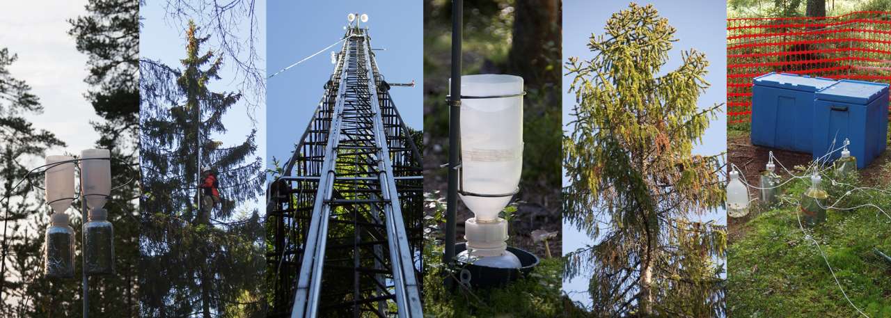
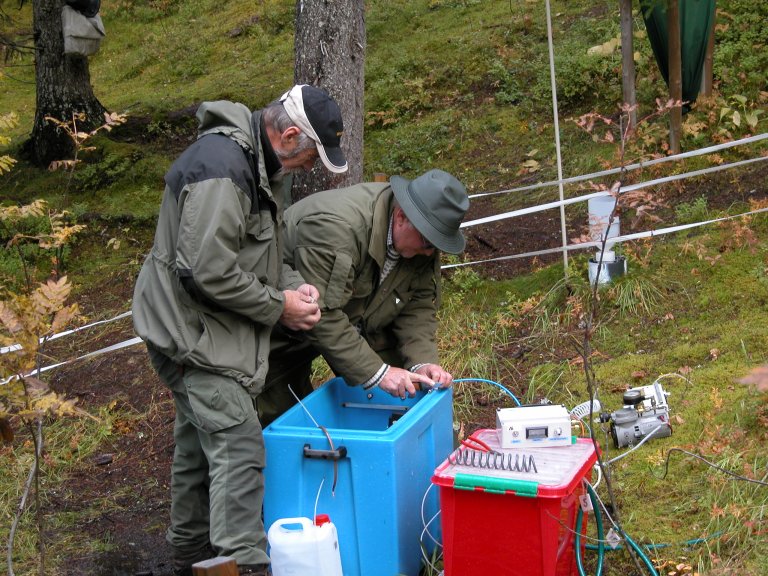
På våre tre intensive skogovervåkingsflater (ICP Forests Level II) i Birkenes, Hurdal og Osen registreres og analyseres mer dyptgående skogøkologiske data og økosystemprosesser, som sammen med kronetilstandsregistreringer bidrar til en bedre forståelse av de enkelte stressfaktorers betydning for skoghelsen. I måleprogrammet på disse flatene inngår det bl.a. analyser av luft-, nedbørs-, jordvanns- og nålekjemi, registreringer av kronetilstand, tilvekstmålinger og vegetasjonsanalyser. Enkelte registreringer utføres årlig eller med noen års mellomrom, andre målinger med bare en til to ukers mellomrom, mens noen målinger pågår kontinuerlig. Metodene for innsamling og analyse av prøver følger den internasjonale manualen til ICP Forests. Lange tidsserier er viktige for å kunne avsløre endringer og påvise trender i skogøkosystemet. I Norge startet vi med målinger og analyser på våre intensive skogovervåkingsflater allerede i 1986 under Overvåkingsprogrammet for skogskader (OPS). Se en grafisk framstilling av noen av våre data fra den intensive skogovervåkingen ved å bruke lenken nederst på sida.

Nedbør samles inn kontinuerlig på åpne områder (fritt fall) og inne i skogen (kronedrypp) ved hver intensive skogovervåkingsflate. Nedbørsprøvene analyseres på månedlig basis for svovel- og nitrogenforbindelser og andre kjemiske elementer, samt pH. Analysene viser graden av avsetning av luftforurensinger gjennom nedbøren.
Målinger av forurensning i luft utføres av Norsk institutt for luftforskning (NILU). Innholdet av svovel- og nitrogenforbindelser, kalium, natrium, kalsium, magnesium og klorid i luft måles daglig på flere stasjoner på fastlands-Norge, hvorav to er tilknyttet våre intensive skogovervåkingsflater. I tillegg overvåkes ozonkonsentrasjonen med UV monitorer flere steder i landet.
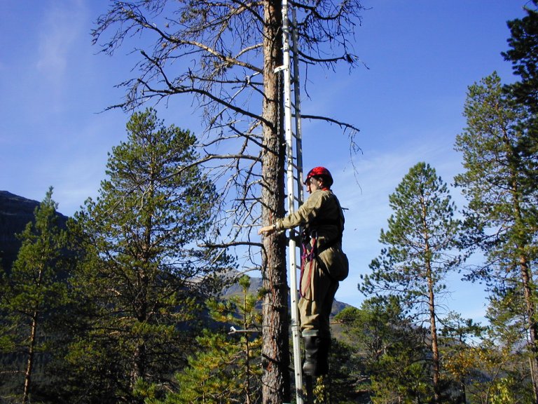
Kjemisk analyse av barnåler blir gjennomført annethvert år av nåleprøver fra fem trær som står i randsona rundt hver overvåkingsflate. Fra hvert prøvetre blir det tatt en prøvegrein fra den øvre del av krona, omtrent mellom den 7. og den 15. greinkrans fra toppen. Både makro- og mikronæringsstoffer samt andre elementer måles både i årets og i fjorårets nåler. Slik kan vi danne oss et bilde av trærnes næringsstatus og tilgangen på næringsstoffer i jordsmonnet. Høye nitrogen- og svovelverdier i nedbøren vil også gjenspeiles i nålekjemien.
Trærnes kronetilstand vurderes årlig og omfatter registreringer av blant annet kronetetthet, kronefarge, skader, blomst- og konglemengde, med særlig vekt på registrering av biotiske og abiotiske skadeårsaker. Unaturlig sterkt nåle- eller bladtap og misfarging som gulfarget bar eller løv i trekrona blir vanligvis tolket som et symptom på stress eller ubalanse. Trærnes kronetilstand brukes derfor som indikator på skogens helsetilstand.
Tilvekst måles hvert femte år på de intensive flatene. Trærnes diameter og høyde måles. Samtidig registreres også skader og døde trær.
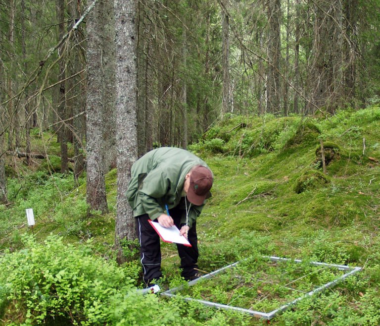
Vegetasjonsanalyser av bakkevegetasjonen gjennomføres hvert femte år. I randsonen rundt overvåkingsflatene er det lagt ut 50 ruter på 1 x 1 meter. For 10 av disse rutene registreres artsmengde som smårutefrekvens. Dette gjøres ved å plassere en ramme inndelt i 25 småruter over hver rute, og telle hvor mange av smårutene hver art av karplanter, moser og lav forekommer i. For alle de 50 rutene registreres prosentvis dekning (fra 1 til 100 %) for samtlige arter. I tillegg registreres artenes dekning i 5 makroflater (7 x 5 m), slik at totalt areal for artsregistreringer er 400 m2. De gjentatte vegetasjonsanalysene brukes til å dokumentere endringer i bakkevegetasjonen over tid. Endringene kan skyldes naturlig suksesjon, økt næringstilgang fra nitrogendeposisjon gjennom nedbør, eller endret lystilgang som følge av hogst i området.
Publikasjoner
Forfattere
Mark A. Anthony Leho Tedersoo Bruno De Vos Luc Croisé Henning Meesenburg Markus Wagner Henning Andreae Frank Jacob Paweł Lech Anna Kowalska Martin Greve Genoveva Popova Beat Frey Arthur Gessler Marcus Schaub Marco Ferretti Peter Waldner Vicent Calatayud Roberto Canullo Giancarlo Papitto Aleksander Marinšek Morten Ingerslev Lars Vesterdal Pasi Rautio Helge Meissner Volkmar Timmermann Mike Dettwiler Nadine Eickenscheidt Andreas Schmitz Nina Van Tiel Thomas W. Crowther Colin AverillSammendrag
Det er ikke registrert sammendrag
Forfattere
Marco Ferretti Arthur Gessler Nathalie Cools Stefan Fleck Rossella Guerrieri Tamara Jakovljević Manuel Nicolas Tiina M. Nieminen Diana Pitar Nenad Potočić Stephan Raspe Marcus Schaub Kai Schwärzel Volkmar Timmermann Monika Vejpustková Lars Vesterdal Petteri Vanninen Peter Waldner Lothar Zimmermann Tanja GM SandersSammendrag
Det er ikke registrert sammendrag
Sammendrag
Det er ikke registrert sammendrag
Forfattere
Arne Verstraeten Nicolas Bruffaerts Fabiana Cristofolini Elena Vanguelova Johan Neirynck Gerrit Genouw Bruno De Vos Peter Waldner Anne Thimonier Anita Nussbaumer Mathias Neumann Sue Benham Pasi Rautio Liisa Ukonmaanaho Päivi Merilä Antti-Jussi Lindroos Annika Saarto Jukka Reiniharju Nicholas Clarke Volkmar Timmermann Manuel Nicolas Maria Schmitt Katrin Meusburger Anna Kowalska Idalia Kasprzyk Katarzyna Kluska Łukasz Grewling Małgorzata Malkiewicz Lars Vesterdal Morten Ingerslev Miklós Manninger Donat Magyar Hugues Titeux Gunilla Pihl Karlsson Regula Gehrig Sandy Adriaenssens Agneta Ekebom Åslög Dahl Marco Ferretti Elena GottardiniSammendrag
Det er ikke registrert sammendrag
Forfattere
Lena Wohlgemuth Pasi Rautio Bernd Ahrends Alexander Russ Lars Vesterdal Peter Waldner Volkmar Timmermann Nadine Eickenscheidt Alfred Fürst Martin Greve Peter Roskams Anne Thimonier Manuel Nicolas Anna Kowalska Morten Ingerslev Päivi Merilä Sue Benham Carmen Iacoban Günter Hoch Christine Alewell Martin JiskraSammendrag
Det er ikke registrert sammendrag
Forfattere
Martin Forsius Maximilian Posch Maria Holmberg Jussi Vuorenmaa Sirpa Kleemola Algirdas Augustaitis Burkhard Beudert Witold Bochenek Nicholas Clarke Heleen de Wit Thomas Dirnböck Jane Frey Ulf Grandin Hannele Hakola Johannes Kobler Pavel Krám Antti-Jussi Lindroos Stefan Löfgren Tomasz Pecka Pernilla Rönnback Krzysztof Skotak Józef Szpikowski Liisa Ukonmaanaho Salar Valinia Milan VáňaSammendrag
Det er ikke registrert sammendrag
Forfattere
Sophia Etzold Marco Ferretti Gert Jan Reinds Svein Solberg Arthur Gessler Peter Waldner Marcus Schaub David Simpson Sue Benham Karin Hansen Morten Ingerslev Mathieu Jonard Per Erik Karlsson Antti-Jussi Lindroos Aldo Marchetto Miklos Manninger Henning Meesenburg Päivi Merilä Pekka Nöjd Pasi Rautio Tanja G.M. Sanders Walter Seidling Mitja Skudnik Anne Thimonier Arne Verstraeten Lars Vesterdal Monika Vejpustkova Wim de VriesSammendrag
Changing environmental conditions may substantially interact with site quality and forest stand characteristics, and impact forest growth and carbon sequestration. Understanding the impact of the various drivers of forest growth is therefore critical to predict how forest ecosystems can respond to climate change. We conducted a continental-scale analysis of recent (1995–2010) forest volume increment data (ΔVol, m3 ha−1 yr−1), obtained from ca. 100,000 coniferous and broadleaved trees in 442 even-aged, single-species stands across 23 European countries. We used multivariate statistical approaches, such as mixed effects models and structural equation modelling to investigate how European forest growth respond to changes in 11 predictors, including stand characteristics, climate conditions, air and site quality, as well as their interactions. We found that, despite the large environmental gradients encompassed by the forests examined, stand density and age were key drivers of forest growth. We further detected a positive, in some cases non-linear effect of N deposition, most pronounced for beech forests, with a tipping point at ca. 30 kg N ha−1 yr−1. With the exception of a consistent temperature signal on Norway spruce, climate-related predictors and ground-level ozone showed much less generalized relationships with ΔVol. Our results show that, together with the driving forces exerted by stand density and age, N deposition is at least as important as climate to modulate forest growth at continental scale in Europe, with a potential negative effect at sites with high N deposition.
Forfattere
Thomas Dirnböck Gisela Pröll Kari Austnes Jelena Beloica Burkhard Beudert Roberto Canullo Alessandra De Marco Maria Francesca Fornasier Martyn Futter Klaus Goergen Ulf Grandin Maria Holmberg Antti-Jussi Lindroos Michael Mirtl Johan Neirynck Tomasz Pecka Tiina Maileena Nieminen Jørn-Frode Nordbakken Maximilian Posch Gert-Jan Reinds Edwin C. Rowe Maija Salemaa Thomas Scheuschner Franz Starlinger Aldona Katarzyna Uzieblo Salar Valinia James Weldon Wieger G W Wamelink Martin ForsiusSammendrag
Det er ikke registrert sammendrag
Forfattere
Jussi Vuorenmaa Algirdas Augustaitis Burkhard Beudert Witold Bochenek Nicholas Clarke Heleen A de Wit Thomas Dirnböck Jane Frey Hannele Hakola Sirpa Kleemola Johannes Kobler Pavel Krám Antti-Jussi Lindroos Lars Lundin Stefan Löfgren Aldo Marchetto Tomasz Pecka Hubert Schulte-Bisping Krzysztof Skotak Anatoly Srybny Józef Szpikowski Liisa Ukonmaanaho Milan Váňa Staffan Åkerblom Martin ForsiusSammendrag
Det er ikke registrert sammendrag
Forfattere
Jan Pisek Henning Buddenbaum Fernando Camacho Joachim Hill Jennifer L.R. Jensen Holger Lange Zhili Liu Arndt Piayda Yonghua Qu Olivier Roupsard Shawn P. Serbin Svein Solberg Oliver Sonnentag Anne Thimonier Francesco VuoloSammendrag
Clumping index (CI) is a measure of foliage aggregation relative to a random distribution of leaves in space. The CI can help with estimating fractions of sunlit and shaded leaves for a given leaf area index (LAI) value. Both the CI and LAI can be obtained from global Earth Observation data from sensors such as the Moderate Resolution Imaging Spectrometer (MODIS). Here, the synergy between a MODIS-based CI and a MODIS LAI product is examined using the theory of spectral invariants, also referred to as photon recollision probability (‘p-theory’), along with raw LAI-2000/2200 Plant Canopy Analyzer data from 75 sites distributed across a range of plant functional types. The p-theory describes the probability (p-value) that a photon, having intercepted an element in the canopy, will recollide with another canopy element rather than escape the canopy. We show that empirically-based CI maps can be integrated with the MODIS LAI product. Our results indicate that it is feasible to derive approximate p-values for any location solely from Earth Observation data. This approximation is relevant for future applications of the photon recollision probability concept for global and local monitoring of vegetation using Earth Observation data.
Forfattere
James Johnson Elisabeth Graf Pannatier Stefano Carnicelli Guia Cecchini Nicholas Clarke Nathalie Cools Karin Hansen Henning Meesenburg Tiina M. Nieminen Gunilla Pihl-Karlsson Hugues Titeux Elena Vanguelova Arne Verstraeten Lars Vesterdal Peter Waldner Mathieu JonardSammendrag
Acid deposition arising from sulphur (S) and nitrogen (N) emissions from fossil fuel combustion and agriculture has contributed to the acidification of terrestrial ecosys- tems in many regions globally. However, in Europe and North America, S deposition has greatly decreased in recent decades due to emissions controls. In this study, we assessed the response of soil solution chemistry in mineral horizons of European forests to these changes. Trends in pH, acid neutralizing capacity (ANC), major ions, total aluminium (Al tot ) and dissolved organic carbon were determined for the period 1995–2012. Plots with at least 10 years of observations from the ICP Forests moni- toring network were used. Trends were assessed for the upper mineral soil (10– 20 cm, 104 plots) and subsoil (40–80 cm, 162 plots). There was a large decrease in the concentration of sulphate (SO 2 4 ) in soil solution; over a 10-year period (2000– 2010), SO 2 4 decreased by 52% at 10–20 cm and 40% at 40–80 cm. Nitrate was unchanged at 10–20 cm but decreased at 40–80 cm. The decrease in acid anions was accompanied by a large and significant decrease in the concentration of the nutrient base cations: calcium, magnesium and potassium (Bc = Ca 2+ + Mg 2+ + K + ) and Al tot over the entire dataset. The response of soil solution acidity was nonuni- form. At 10–20 cm, ANC increased in acid-sensitive soils (base saturation ≤10%) indicating a recovery, but ANC decreased in soils with base saturation >10%. At 40–80 cm, ANC remained unchanged in acid-sensitive soils (base saturation ≤20%, pH CaCl 2 ≤ 4.5) and decreased in better-buffered soils (base saturation >20%, pH CaCl 2 > 4.5). In addition, the molar ratio of Bc to Al tot either did not change or decreased. The results suggest a long-time lag between emission abatement and changes in soil solution acidity and underline the importance of long-term monitor- ing in evaluating ecosystem response to decreases in deposition.
Forfattere
Anita Nussbaumer Peter Waldner Vladislav Apuhtin Fatih Aytar Sue Benham Filippo Bussotti Johannes Eichhorn Nadine Eickenscheidt Petr Fabianek Lutz Falkenried Stefan Leca Martti Lindgren María José Manzano Serrano Stefan Neagu Seppo Nevalainen Jozef Pajtik Nenad Potočić Pasi Rautio Geert Sioen Vidas Stakėnas Celal Tasdemir Iben Margrete Thomsen Volkmar Timmermann Liisa Ukonmaanaho Arne Verstraeten Sören Wulff Arthur GesslerSammendrag
Det er ikke registrert sammendrag
Forfattere
Jussi Vuorenmaa Algirdas Augustaitis Burkhard Beudert Nicholas Clarke Heleen de Wit Thomas Dirnböck Jane Frey Martin Forsius Iveta Indriksone Sirpa Kleemola Johannes Kobler Pavel Kram Antti-Jussi Lindroos Lars Lundin Tuija Ruoho-Airola Liisa Ukonmaanaho Milan VánaSammendrag
Empirical evidence based on integrated environmental monitoring including physical, chemical and biological variables is essential for evaluating the ecosystem benefits of costly emission reduction policies. The international multidisciplinary ICP IM (International Cooperative Programme on Integrated Monitoring of Air Pollution Effects on Ecosystems) programme studies the integrated effects of air pollution and climate change on ecosystems in unmanaged and calibrated forested catchments. We calculated site-specific annual input-output budgets for sulphate (SO4) and total inorganic nitrogen (TIN NO3- N + NH4-N) for 17 European ICP IM sites in 1990–2012. Temporal trends for input (deposition) and output (runoff water) fluxes and the net retention/net release of SO4 and TIN were also analysed. Large differences in the input and output fluxes of SO4 and TIN reflect important gradients of air pollution effects in Europe, with the highest deposition and runoff water fluxes at IM sites located in southern Scandinavia and in parts of Central and Eastern Europe and the lowest fluxes at more remote sites in northern European regions. A significant decrease in the total (wet + dry) deposition of non-marine SO4 and bulk deposition of TIN was found at 90% and 65% of the sites, respectively. Output fluxes of non-marine SO4 in runoff decreased significantly at 65% of the sites, indicating positive effects of the international emission abatement actions in Europe during the last 20 years. Catchments retained SO4 in the early and mid1990s, but this shifted towards a net release in the late 1990s, which may be due to the mobilization of legacy S pools accumulated during times of high atmospheric SO4 deposition. Despite decreased deposition, TIN output fluxes and retention rates showed a mixed response with both decreasing (9 sites) and increasing (8 sites) trend slopes, and trends were rarely significant. In general, TIN was strongly retained in the catchments not affected by natural disturbances. The long-term annual variation in net releases for SO4 was explained by variations in runoff and SO4 concentrations in deposition, while a variation in TIN concentrations in runoff was mostly associated with a variation of the TIN retention rate in catchments. The net release of SO4 from forest soils may delay the recovery from acidification for surface waters and the continued enrichment of nitrogen in catchment soils poses a threat to terrestrial biodiversity and may ultimately lead to a higher TIN runoff through N-saturation. Continued monitoring and further evaluations of mass balance budgets are thus needed.
Forfattere
Nathalie Cools Arne Verstraeten Wendelin Weis Stefano Carnicelli Guia Cecchini Nicholas Clarke Elisabeth Graf Pannatier Jim Johnson Mathieu Jonard Henning Meesenburg Tiina M. Nieminen Gunilla Pihl Karlsson Elena Vanguelova Jörg Sintermann Lars Vesterdal Karin HansenSammendrag
Det er ikke registrert sammendrag
Forfattere
Anita Nussbaumer Peter Waldner Sophia Etzold Arthur Gessler Sue Benham Iben Margrete Thomsen Bruno Bilde Jørgensen Volkmar Timmermann Arne Verstraeten Geert Sioen Pasi Rautio Liisa Ukonmaanaho Mitja Skudnik Vladislav Apuhtin Sabine Braun Alexandra WauerSammendrag
Det er ikke registrert sammendrag
Forfattere
Matthieu Jonard Alfred Fürst Arne Verstraeten Anne Thimonier Volkmar Timmermann Nenad Potocic Peter Waldner Sue Benham Karin Hansen Päivi Merilä Quentin Ponette Ana C. de la Cruz Peter Roskams Manuel Nikolas Luc Croisé Morten Ingerslev Giorgio Matteucci Bruno Decinti Marco Bascietto Pasi RautioSammendrag
Det er ikke registrert sammendrag
Forfattere
Marco Ferretti Tanja GM Sanders Alexa Michel Vicent Calatayud Nathalie Cools Elena Gottardini Matthias Haeni Karin Hansen Nenad Potocic Marcus Schaub Volkmar Timmermann Serina Trotzer Elena VanguelovaSammendrag
Det er ikke registrert sammendrag
Forfattere
Peter Waldner Anne Thimonier Elisabeth Graf Pannatier Sophia Etzold Maria Schmitt Aldo Marchetto Pasi Rautio Kirsti Derome Tiina M. Nieminen Seppo Nevalainen Antti-Jussi Lindroos Päivi Merilä Georg Kindermann Markus Neumann Nathalie Cools Bruno de Vos Peter Roskams Arne Verstraeten Karin Hansen Gunilla Pihl Karlsson Hans-Peter Dietrich Stephan Raspe Richard Fischer Martin Lorenz Susanne Iost Oliver Granke Tanja G. M. Sanders Alexa Michel Hans-Dieter Nagel Thomas Scheuschner Primož Simončič Klaus von Wilpert Henning Meesenburg Stefan Fleck Sue Benham Elena Vanguelova Nicholas Clarke Morten Ingerslev Lars Vesterdal Per Gundersen Inge Stupak Mathieu Jonard Nenad Potočić Mayte MinayaSammendrag
Det er ikke registrert sammendrag
Forfattere
Marta Camino-Serrano Bert Gielen Sebastiaan Luyssaert Philippe Ciais Sara Vicca Bertrand Guenet Bruno de Vos Nathalie Cools Bernhard Ahrens M. Altaf Arain Werner Borken Nicholas Clarke Beverley Clarkson Thomas Cummins Axel Don Elisabeth Graf Pannatier Hjalmar Laudon Tim Moore Tiina M. Nieminen Mats B. Nilsson Matthias Peichl Luitgard Schwendenmann Jan Siemens Ivan A. JanssensSammendrag
Det er ikke registrert sammendrag
Forfattere
Giulia Carriero Juha-Pekka Tuovinen Nicholas Clarke Giorgio Matteucci Rainer Matyssek Gerhard Wieser Teis Nørgaard Mikkelsen Richard Fischer Pavel Cudlin Yusuf Serengil Fabio Boscaleri Carlo Calfapietra Zhaozhong Feng Elena PaolettiSammendrag
Det er ikke registrert sammendrag
Forfattere
Peter Waldner Aldo Marchetto Anne Thimonier Maria Schmitt Michela Rogora Oliver Granke Volker Mues Karin Hansen Gunilla Pihl Karlsson Daniel Žlindra Nicholas Clarke Arne Verstraeten Andis Lazdins Claus Schimming Carmen Iacoban Antti-Jussi Lindroos Elena Vanguelova Sue Benham Henning Meesenburg Manuel Nicolas Anna Kowalska Vladislav Apuhtin Ulle Napa Zora Lachmanová Ferdinand Kristoefel Albert Bleeker Morten Ingerslev Lars Vesterdal Juan Molina Uwe Fischer Walter Seidling Mathieu Jonard Philip O'Dea James Johnson Richard Fischer Martin LorenzSammendrag
Det er ikke registrert sammendrag


