Csilla Farkas
Research Professor
Biography
Csilla Farkas was graduated as a hydrologist and holds a Ph.D. in earth sciences. She has worked in the fields of soil hydrology, soil erosion, catchment hydrology and water quality. She has experience i) in mathematical modelling of land use, management, and climate change indicated changes in water, particle and nutrient transport in the soil and within the landscape and ii) in studying the spatio-temporal variability of soil properties and water balance elements.
Abstract
Small retention ponds are increasingly recognised as effective nature-based solutions for managing hydrological extremes in Norway’s agricultural catchments. Typically located in upper catchment areas or at the forest–agriculture interface, these ponds temporarily store runoff during intense rainfall events and snowmelt. In addition to flood mitigation, they provide important co-benefits by reducing soil erosion and sediment transport and by protecting agricultural drainage systems from erosion and overflow during extreme events, thereby supporting long-term soil productivity. Although individual storage volumes are limited, their cumulative impact at the catchment scale can be substantial when retention ponds are strategically distributed across the landscape. This study investigates the potential effects of small retention ponds using process-based hydrological modelling with SWAT+ to support catchment-scale climate adaptation planning in a Norwegian agricultural catchment. SWAT+ enables an improved representation of hydrological connectivity between managed landscapes and the stream network through its flexible spatial structure and rule-based management algorithms. The model is calibrated using a constraint-based approach that integrates both soft and hard data to represent streamflow and sediment dynamics in the Lierelva catchment. Multiple retention ponds are implemented to assess their cumulative effects on streamflow and sediment transport. Finally, the study discusses key challenges associated with modelling catchment–NBS interactions using SWAT+.
Abstract
No abstract has been registered
Abstract
No abstract has been registered
Division of Environment and Natural Resources
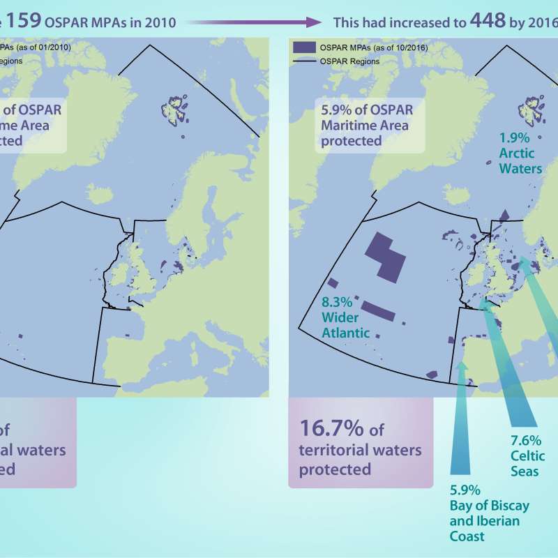
Riverine Inputs and Direct Discharges - RID
The Comprehensive Riverine Inputs and Direct Discharges (RID) programme aims to monitor and assess all inputs and discharges of selected contaminants to the OSPAR maritime area and its regions that are carried via rivers into tidal waters, or are discharged directly into the sea, for example through sewage pipelines or activities like aquaculture inputting substances directly.

Division of Environment and Natural Resources
MARCHES - Methodologies for Assessing the Real Costs to Health of Environmental Stressors
Division of Environment and Natural Resources
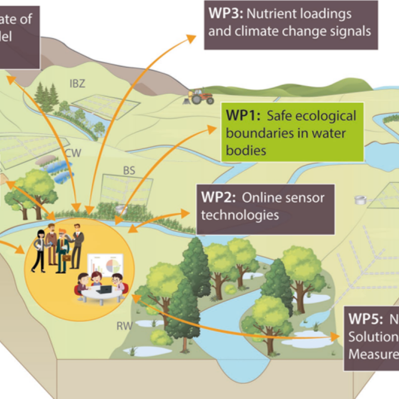
NORDBALT ECOSAFE: Nitrogen and phosphorus load reduction approach within safe ecological boundaries for the Nordic Baltic region
About the project
Division of Environment and Natural Resources
ENGAGE: Europe Nutrient Management - Guided Approaches for Greater Export reduction
ENGAGE aims to operationalise a novel vision for the future of multi-scale nutrientexport reduction and associated ecosystem services in national andtransboundary/international river basins in Europe by bringing together robuststakeholder engagement strategies with coupled state-of-the-art computationalhydrology techniques and online interactive use-tailored DS tool approaches that integrate remote sensing, socio-economic, governance, and society-change decisionelements.
Division of Food Production and Society
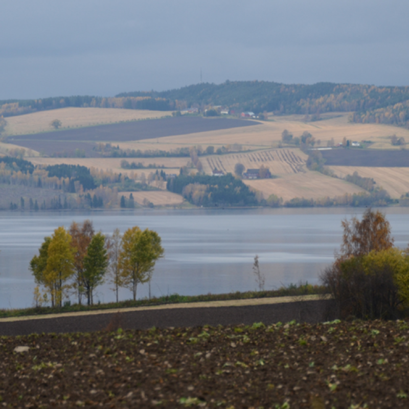
Agricultural mitigation measures and the value of water quality improvements
Agriculture is one of the main sources of water pollution in Norway, and an important contributor to GHG emissions.