Ryan Bright
Seniorforsker
Biografi
Sammendrag
The top‐of‐atmosphere (TOA) albedo controls the amount of solar energy absorbed by Earth and is influenced by the reflectivity of both the atmosphere and surface. With considerable changes in land use over the past few decades it is reasonable to question whether a perturbed surface albedo has influenced TOA albedo over the corresponding period. Here, we identify regions for which surface albedo changes have been the dominant driver of TOA albedo trends from 2001 to 2020 and examine the degree to which this relates to changes in snow cover, surface soil moisture, and vegetation density and greenness. We show that land surface albedo changes have been the dominant driver of TOA albedo trends in 10.0% of the global land area, within which surface albedo decreases have led to increases in absorbed solar radiation of 0.737 ± 4.984 Wm −2 from 2001 to 2020. This corresponds to global change in absorbed solar radiation of 0.019 ± 0.812 Wm −2 , which is equivalent to approximately 7.0% of the radiative forcing from anthropogenic CO 2 emissions from 2011 to 2019 (IPCC, 2021, https://doi.org/10.1017/9781009157896.009 ). Net TOA darkening above tundra and deserts constitutes 38.6% and 21.4%, respectively, to the radiative feedback identified, whereas temperate biomes induced net TOA brightening, corresponding to 22.3%. Collectively, changes in snow cover, vegetation density and greenness, and surface soil moisture drive 68.5% of the surface albedo changes. The importance of surface albedo in explaining TOA albedo trends for parts of the globe highlights the relevance of land surface changes in understanding Earth's energy imbalance.
Sammendrag
Det er ikke registrert sammendrag
Sammendrag
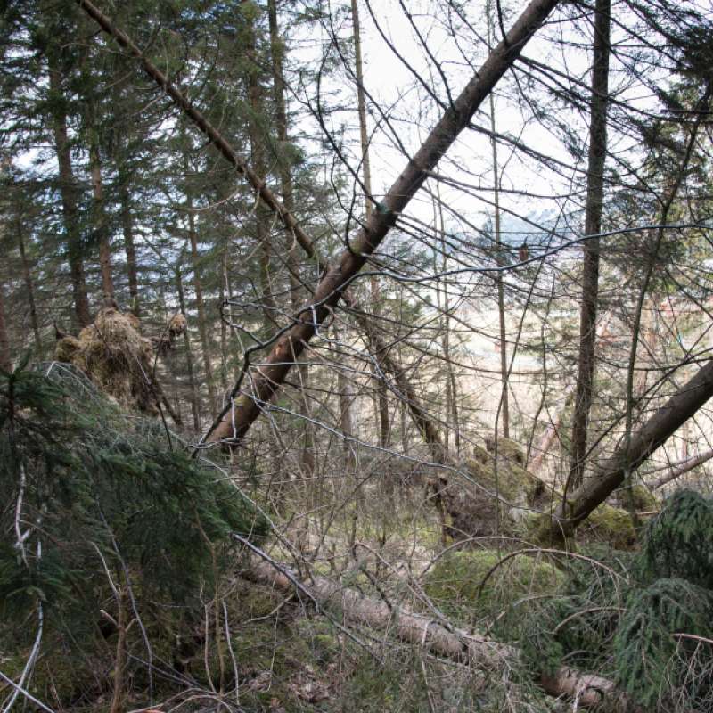
Norske skog- og landområder tar opp store mengder CO₂ hvert år. De siste ti årene har imidlertid dette karbonopptaket blitt redusert med hele 40 prosent. Mye av forklaringen er eldre skog, tørke, barkbiller og skogdød.
Divisjon for skog og utmark
NCS-REVISE - Revising the climate change mitigation potential of natural climate solutions
Mange land tar sikte på å nå sine klimamål ved å øke karbonopptaket i skog, enten gjennom å utvide skogarealer eller ved å gjenopprette bærekraftig skogforvaltning i dårlig forvaltede skoger. Det er økende vitenskapelig enighet om potensialet til slike landbaserte tiltak, kjent som «naturlige klimaløsninger» (Natural Climate Solutions, NCS), til å bidra til å dempe klimaendringene ved å fjerne ekstra karbondioksid fra atmosfæren.

Divisjon for bioteknologi og plantehelse
FORESIGHT: Forest opportunities, risks and ecosystem services in a changing climate in Norway
Forest ecosystems are increasingly under pressure from climate change, emerging pests and pathogens, and more frequent extreme weather events. When such disturbances occur simultaneously—or interact with one another—the risk of severe damage can increase substantially. The FORESIGHT project aims to understand these complex, interacting challenges and to translate this knowledge into practical applications.
Divisjon for bioteknologi og plantehelse
FORESIGHT: Forest opportunities, risks and ecosystem services in a changing climate in Norway
Skog er i stadig større grad utsatt for press fra klimaendringer, nye skadegjørere og mer ekstremvær. Når slike forstyrrelser opptrer samtidig – eller påvirker hverandre – kan risikoen for store skader øke kraftig. FORESIGHT-prosjektet tar mål av seg til å forstå nettopp disse sammensatte utfordringene, og gjøre kunnskapen nyttig i praksis.
Divisjon for skog og utmark
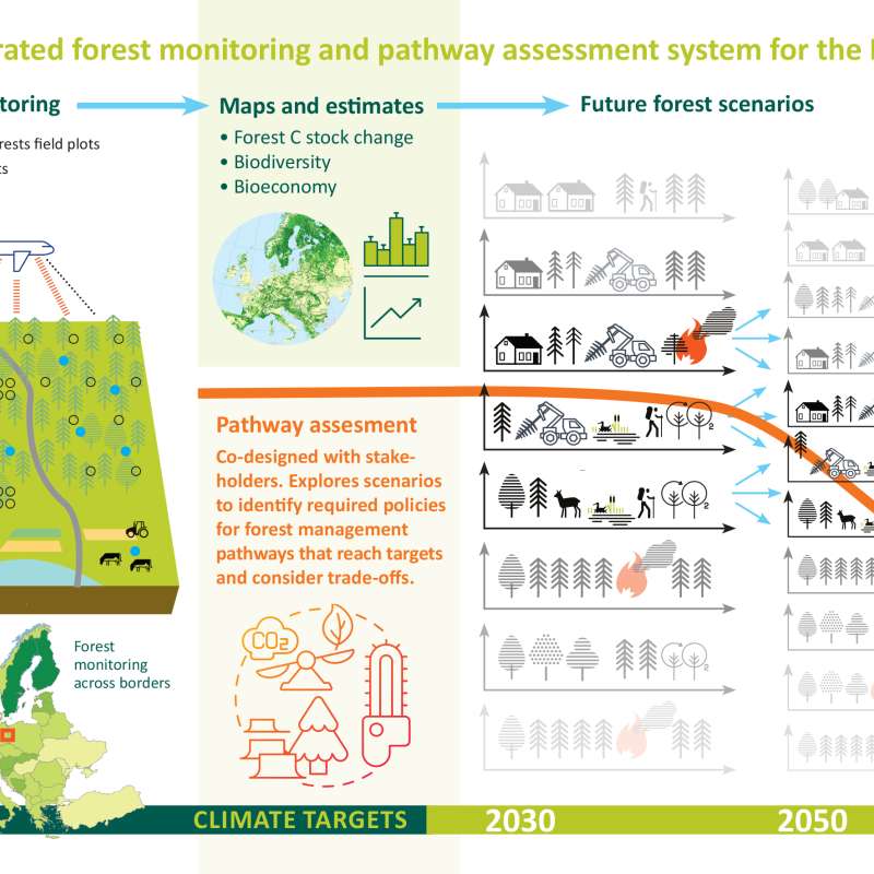
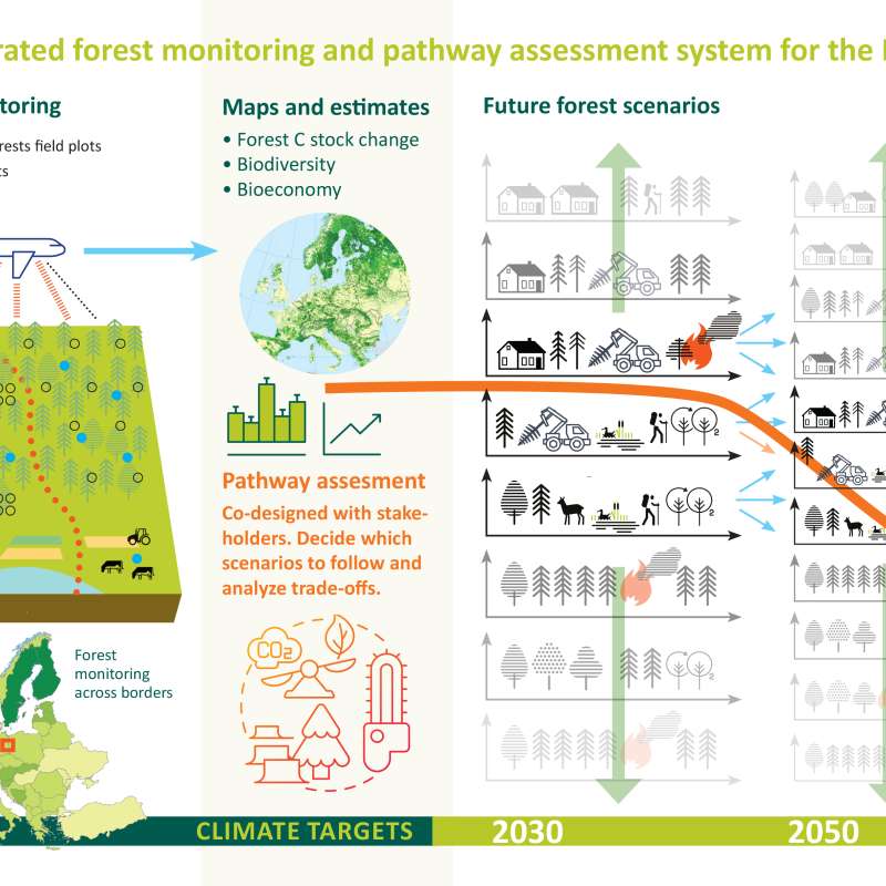
PathFinder - Towards an Integrated Consistent European LULUCF Monitoring and Policy Pathway Assessment Framework
Divisjon for skog og utmark
PathFinder
Towards an Integrated Consistent European LULUCF Monitoring and Policy Pathway Assessment Framework