Risk warning
Risk of widespread tree mortality (click on the zones in the map)
The risk warning is given for each of 3 geographical zones (see description below) within the total area covered by the bark beetle monitoring program.
There are five risk levels:
Risk level | Description | Map symbol |
1. Low risk | No indication of increased risk | Green |
2. Medium risk (locally) | Some localities have some increased risk | Yellow, dotted |
3. Medium risk (widespread) | Much of the zone has some increased risk | Yellow, solid |
4. High risk (locally) | Some localities have considerably increased risk | Red, dotted |
5. High risk (widespread) | Much of the zone has considerably increased risk | Red, solid |
The risk warning comes with a three-level estimate of uncertainty:
Uncertainty | Description |
|
Low | No or little information is missing. Data is consistent and points in the same direction for several risk factors. |
|
Medium | Some information is missing and/or data is inconsistent or conflicting, pointing in different directions for different risk factors |
|
High | Most information is missing. Data is inconsistent or conflicting for different risk factors. |
|
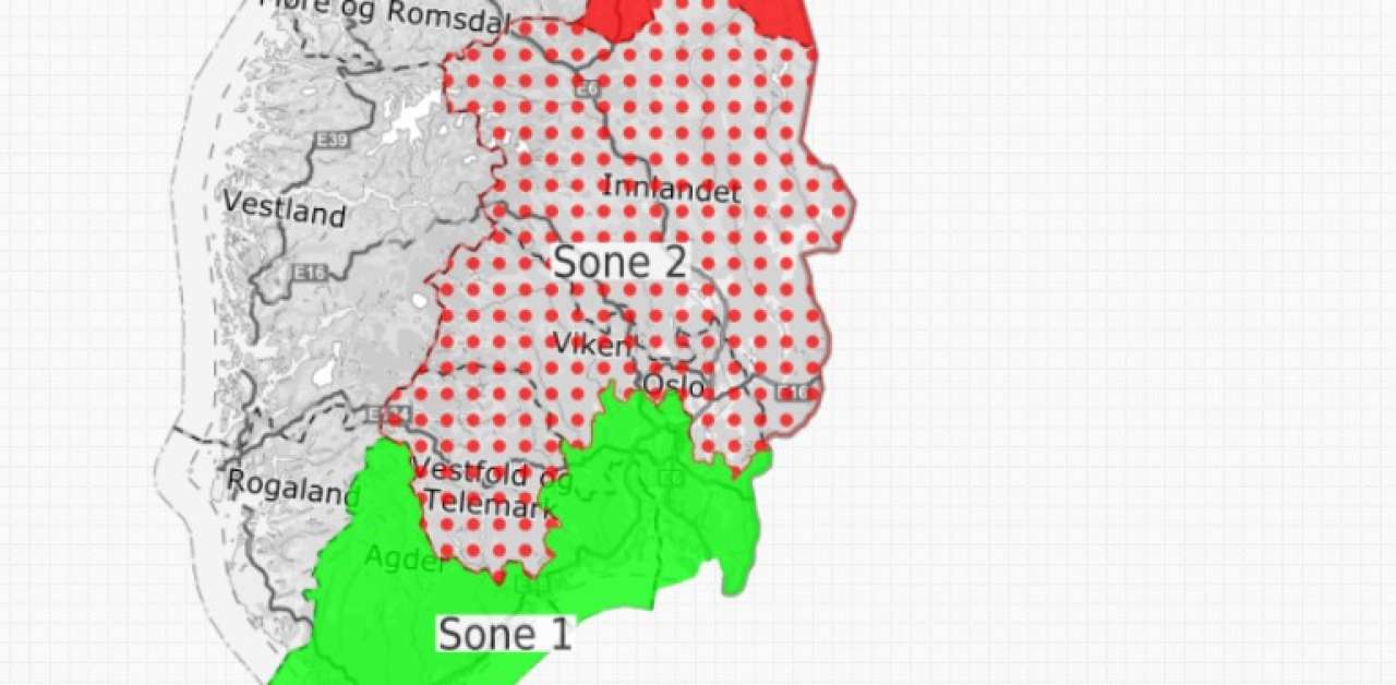
Risk warning for three geographical zones
The total area covered by the bark beetle monitoring program is divided into three zones. The delimitation of the zones is based on biomes/ecozones and follows the borders of old counties and municipalities.
Zone 1 includes the boreonemoral (hemiboreal) ecozone and other parts of the “Sørlandet” region:
- Vest-Agder (whole county)
- Aust-Agder (whole county)
- Telemark: Kragerø, Bamble, Porsgrunn, Skien, Siljan, Sauherad
- Vestfold (whole county)
- Buskerud: Kongsberg, Øvre Eiker, Nedre Eiker, Modum, Hole, Drammen, Lier, Røyken, Hurum
- Oslo (whole county)
- Akershus: all municipalities west of Enebakk and Lørenskog (i.e., Vestby, Ski, Ås, Frogn, Oppegård, Nesodden, Asker, Bærum)
- Østfold (whole county)
Zone 2 includes the southern boreal and middle boreal parts of the “Østlandet” region (i.e., interior parts of Østlandet):
- Hedmark (whole county)
- Oppland (whole county)
- Buskerud: all municipalities not situated in Zone 1
- Telemark: all municipalities not situated in Zone 1
- Akershus: all municipalities not situated in Zone 1
Zone 3 includes the boreal parts of the “Trøndelag” and “Helgeland” regions (mostly southern and middle boreal):
- Sør-Trøndelag (whole county)
- Nord-Trøndelag (whole county)
- Nordland (north to Saltfjellet)
Contacts

Paal Krokene
Research Professor
-
Division of Biotechnology and Plant Health
(+47) 995 16 013 paal.krokene@nibio.no Office Location: Ås H8
Links
To map layers in KildenContacts
Paal Krokene
Research Professor
-
Division of Biotechnology and Plant Health
(+47) 995 16 013 paal.krokene@nibio.no Office Location: Ås H8