Kilden maps show 3D and receive GPS data
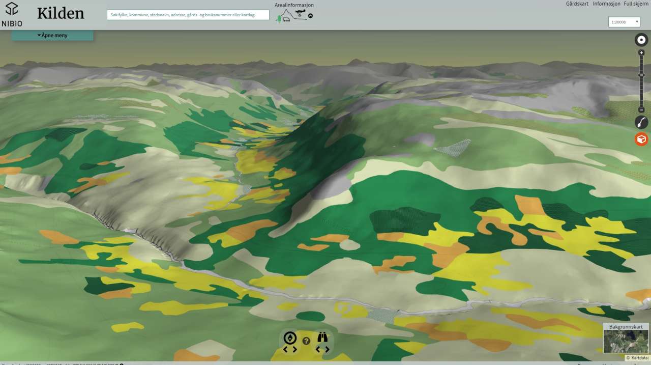
From the map "Kilden"
In the latest version of Kilden, we can see map data in three dimensions, which gives us better visualization of the landscape. We can also upload GPS data and see it alongside other maps.
“One of the aims of the new development was the desire to make it easier to understand the maps. We know that around half of ‘average people’ find it challenging to understand maps,” says Project Manager Tove Vaaje-Kolstad.
“Aerial images improve the way we convey the information, while ‘tilting’ the ground and showing features like valleys, hills and mountain ranges, as we do in 3-D, improves our understanding even further.”
The other element of the innovation is the ability to import GPS tracking. Whether it is a farmer who needs to document newly cultivated land or a hunting society that wishes to enter the location of a hide in its area, it is now possible to transfer a GPS file into Kilden.
“The only technology needed is a smartphone,” says the enthusiastic project manager.
“We noticed that the service can be used for a range of purposes. For example, updating the map for control purposes in regard to area-based subsidies can be accomplished faster if the farmer himself contributes with new data.”
Make your own acreage report
In the new Kilden, it is possible for people to draw in an area on the map to obtain information about the land resources within that area: For example, to find out how much is forest or cultivated land, the quality of agricultural land, how much can be brought under cultivation and turned into fully cultivated land, or whether marshland is shallow or deep. Agricultural properties on which agricultural land may be disused is one of the menu options.
The acreage report makes it easier for regional and municipal agricultural administrations to attend to their responsibility under national guidelines governing the protection of land resources, or as the Ministry of Agriculture and Food puts it: ‘land of national or significant value.’ Protecting the soil and cultural landscape is part of this responsibility.
Contacts
Tove Vaaje-Kolstad
Head of Department
-
Division of Survey and Statistics
(+47) 930 08 377 tove.vaaje-kolstad@nibio.no Office Location: Ås O43
Contacts
Tove Vaaje-Kolstad
Head of Department
-
Division of Survey and Statistics
(+47) 930 08 377 tove.vaaje-kolstad@nibio.no Office Location: Ås O43