New model changes erosion risk map
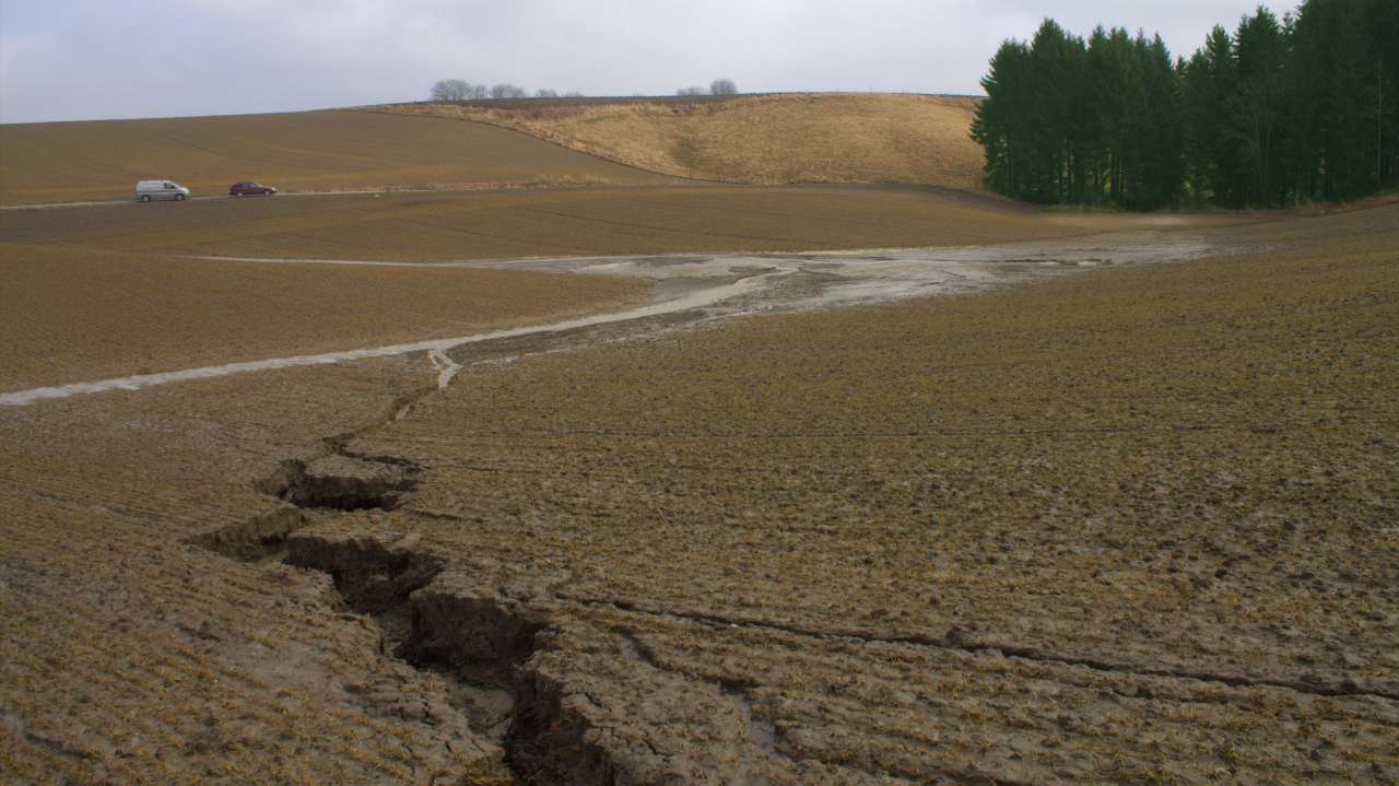
Photo: Inga Greipsland.
In 2021 NIBIO launched two erosion risk maps that show the estimated risk of sheet erosion and ephemeral gully erosion on agricultural land. The maps are based on a new model using local climate data.
Erosion can lead to topsoil losses from land to watercourses, which in turn can result in poor water quality due to accompanying nutrients in soil particles. Two new erosion risk maps divide agricultural land areas into different risk categories, so that farmers can implement measures where they are most needed.
The maps depict two different erosion processes: sheet erosion and ephemeral gully erosion, each with its own map.
When rainwater hits the ground, some of it is absorbed, some is used by plants, some evaporates, and some runs off on the surface. The surface water can carry soil particles with it. When this happens evenly across an entire area of land, it is called sheet erosion. Gully erosion is when the water begins to carve out hollows and depressions.
The model estimates annual soil loss per decare caused by sheet erosion. It also calculates where the risk of gully erosion is the greatest. The model is based on the best data sources available.
Detailed data regarding degree and length of slope is retrieved from a digital terrain model. Detailed information about soil quality is also included. Monthly runoff is simulated using daily local numbers for precipitation, air temperature and evaporation.
The new maps are currently the best basis we have for evaluating erosion risk on Norwegian agricultural land. Local assessment is important in order to consider factors that the model does not take into account.
The previous erosion risk map was the basis for grants through the regional environmental grant program (RMP). Based on the new maps, the Norwegian Agriculture Agency has created a special grant map that will be used for RMP in 2021. Both the grant map and the risk maps for sheet and gully erosion are available through NIBIO’s map portal, kilden.nibio.no.
Contacts

Hege Ulfeng
Senior Communications Adviser
-
Department of Communications
(+47) 474 04 720 hege.ulfeng@nibio.no Office Location: Ullensvang
Contacts
Hege Ulfeng
Senior Communications Adviser
-
Department of Communications
(+47) 474 04 720 hege.ulfeng@nibio.no Office Location: Ullensvang